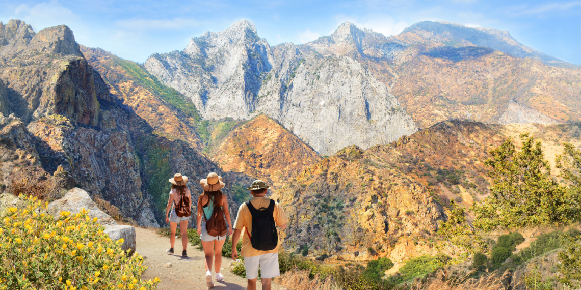
Do you love adventure and want to see California’s natural beauty up close? You’re in the right place! In this guide, you’ll find the top 10 hiking trails in California. You’ll see everything from the ocean cliffs to giant redwoods. This journey through California’s diverse landscapes will fill you with wonder. It’s for both experienced hikers and those just starting. You’ll discover some of the best places to walk in California.
Key Takeaways
- Discover the top 10 best hiking trails in California, showcasing the state’s natural wonders.
- Explore a range of trails from coastal cliffs to towering redwoods, catering to hikers of all skill levels.
- Uncover breathtaking landscapes, unique geological formations, and unforgettable adventures that will inspire you to explore California’s great outdoors.
- Learn about the diverse terrain, distance, and elevation gain of each trail to help you plan your next hiking adventure.
- Gain insider tips and must-know information to make the most of your experience on these top-rated hiking trails in California.
Introduction
Hiking in California is amazing because of its stunning natural beauty. You can see the grand Sierra Nevada mountains or enjoy calm coastal walks. Exploring the state’s top 10 hiking trails helps us value this outdoor activity more. It also shows the beauty of these special places.
Importance of Hiking in California
Hiking in California deepens your connection with nature. You get to see diverse environments, like rocky coastlines and green forests. This lets you enjoy the wilderness. Plus, hiking boosts your health and mood. It helps you relax away from daily stress, offering peace and adventure together.
Regular hikes are good for your heart, muscles, and mind. They let you take a break from busy life. You find happiness in nature. This promotes a better way of living and respect for our planet.
Criteria for Selecting the Best Trails
We picked the top 10 trails in California with outdoor fans in mind. These trails offer unforgettable sights and are perfect for day trips. We also looked at trail safety and how they protect the environment. Our goal was to choose trails that everyone could enjoy, regardless of skill level.
These best 10 trails aim to highlight California’s natural beauty. They encourage outdoor fun and inspire both experienced hikers and beginners. Get ready to explore these amazing trails and be astonished by what California has to offer.
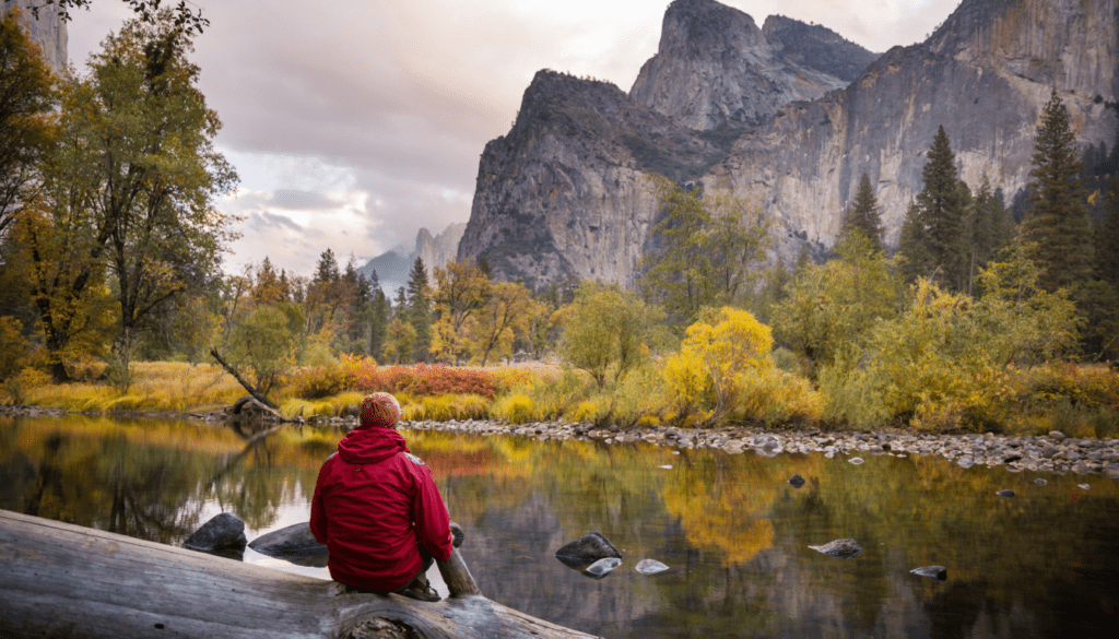
Fern Canyon
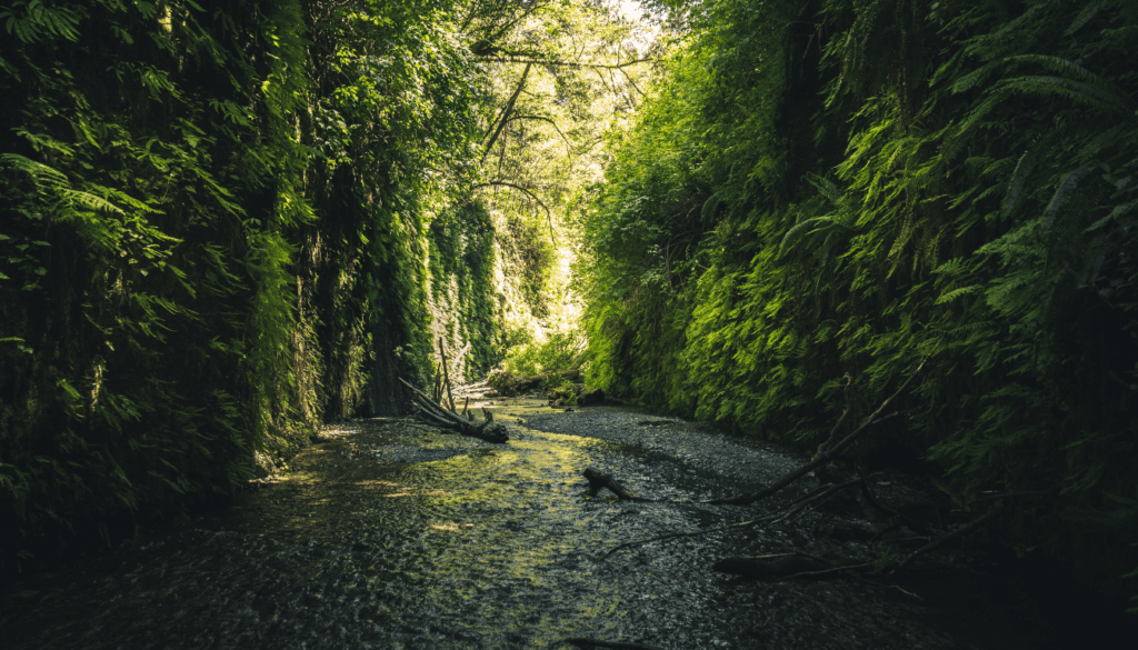
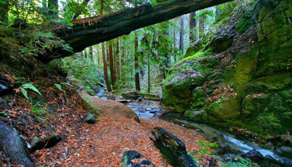
Fern Canyon is a short, stunning hike on the California coast. The hard bit is the drive. But, the path is through a lush canyon with amazing views at every turn. It’s one of the top coastal hikes in California.
The journey to Fern Canyon includes an 8-mile dirt road. You will cross two streams. The first crossing is shallow, about 6 inches. The water depth changes with the seasons. Having a high-clearance, 4-wheel-drive is a good idea for this road.
After arriving at the trailhead, Fern Canyon’s hike is a 1.5-mile loop. It has a 450 feet elevation gain. The trail leads through a deep, fern-filled canyon with high walls. To enjoy it with fewer people, visit around 9 AM.
| Trail Details | Highlights |
|---|---|
|
|
Seeing elk is a highlight of the Fern Canyon drive. The area also has giant redwoods, reaching over 18 feet in diameter. You’ll find deer ferns, huckleberries, and skunk cabbage, too.
Fern Canyon is a must for those wanting a top hike in California. It has amazing scenery, a special geological formation, and a view of the beautiful California coast.
Lembert Dome
In the beautiful Yosemite National Park, you’ll find the Lembert Dome. It isn’t too hard to climb compared to other big rocks in the park. It lets hikers see amazing views of the Tuolumne Meadows.
Trail Details and Highlights
The Lembert Dome hike is about 3 miles roundtrip. This makes it doable for many adventurers. It’s not too hard, but you’ll enjoy a bit of a climb. The path isn’t flat all the way but it’s not super tough either.
As you walk up, the trail shows off Yosemite’s wild beauty. It goes through forests and by a pretty creek. You’ll be looking forward to the great views at the dome’s top. And when you get up there, you’ll see stunning sights all around. This includes the Tuolumne Meadows, Mt. Dana, and Cathedral Peak.
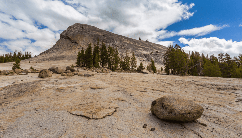
Don’t forget your hiking boots, water, and sun protection for the Lembert Dome hike. There’s not much shade, so the sun can be strong. With these items, you can take in the beauty of this granite dome hike and enjoy your time in Yosemite.
| Lembert Dome Hike Stats | Packing Suggestions |
|---|---|
|
|
Whiskeytown Falls
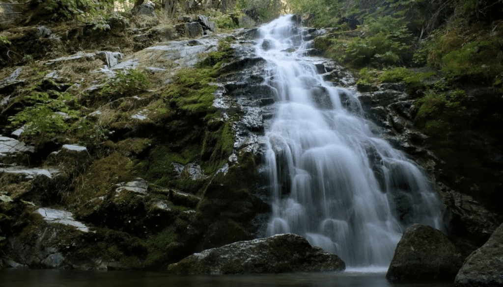
Located just 45 minutes from Redding, the Whiskeytown Falls hike is a treasure. It’s perfect for those who love a good challenge in a beautiful setting. The trail spans 3 miles and takes you to a stunning waterfall in California.
Walking the trail, I was entranced by the beauty around me. The mix of deep greens and earthy browns stood out. This was all leading to the highlight – Whiskeytown Falls. At 220 feet tall, it’s the biggest in the area and absolutely marvelous.
“The Whiskeytown Falls hike is an absolute must-do for anyone exploring the beautiful hikes near Redding, CA. The sheer power and elegance of the waterfall make it one of my personal favorites in the state.”
The path to Whiskeytown Falls is challenging with a climb of 700 feet. But, the incredible views and the chance to see this amazing sight make it all worth it. You’ll also enjoy various plants and animals on your way there.
For a shorter and easier walk, try the Crystal Creek Falls Trail. It’s only 0.5 miles and great for a simple stroll. You’ll see a lovely 40-foot waterfall here. It’s ideal for a summer picnic or a quick cool-off. Whichever waterfall you pick, Whiskeytown National Recreation Area is a must-see for anyone who loves the outdoors.
Taft Point and Sentinel Dome
When you visit Yosemite National Park, two hikes offer amazing views. The Taft Point and Sentinel Dome trails are about two miles each. They let you see the park’s beauty up close.
Taft Point Trail Highlights
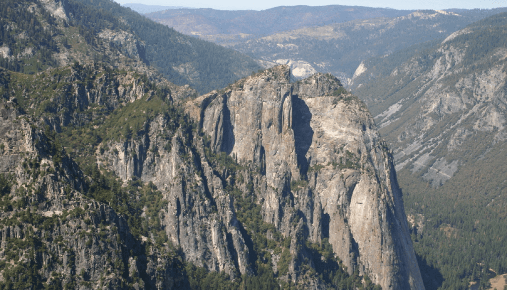
The Taft Point trail is 2.3 miles long and fairly easy with a small elevation change. Hikers see huge glacial cracks, some as deep as 100 feet, leading to Yosemite Valley.
The best part is the view at Taft Point. You can see El Capitan, Yosemite Falls, and more. Spending 45 minutes taking in the sights and snapping photos is a great idea.
Sentinel Dome Trail Highlights
Sentinel Dome’s trail spans 2.1 miles and climbs 456 feet. This makes it harder than Taft Point. But the view from Sentinel Dome’s top is truly breathtaking.
From here, you get to see Yosemite and Nevada Falls, Half Dome, and El Capitan. Remember to wear sunscreen and a hat because the trail is mostly sunny.
A loop trail combines both Sentinel Dome and Taft Point for a longer, 5.1-mile walk. It rises 1,122 feet in elevation, offering a moderate challenge. This hike lets you explore more of Yosemite’s South Rim and its incredible views.
Choosing the Taft Point or Sentinel Dome trail, or doing the loop, means you’ll enjoy some of the best Yosemite hikes with views out there. Aim for summer when Glacier Point Road, the starting point, is open 10 AM to 4:30 PM.
Eagle Lake
In South Lake Tahoe, the Eagle Lake hike is a gem in Emerald Bay State Park. It’s loved by both new hikers and experienced ones. You’ll find stunning views all along the way.
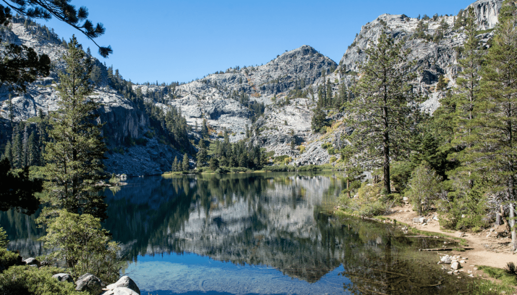
The round trip is 3-4 miles with a 400-foot climb. You’ll walk through lush greenery. Along the trail, Eagle Falls wows visitors with its beauty.
One highlight is the chance to walk over the falls on a bridge. Keep going and you’ll see Eagle Lake. It’s surrounded by tall peaks and pure nature.
For a smooth start, come early, especially in summer. The parking lot fills fast. In 2018, parking cost $5. Don’t forget to get a wilderness permit too.
This hike is perfect for both challenge-seekers and families. It leaves everyone in awe of nature. You won’t forget the beauty of Lake Tahoe after this.
“The Eagle Lake hike is a must-do for anyone visiting the Emerald Bay area. The views are simply breathtaking, and the trail offers a perfect balance of challenge and reward.” – Outdoor Enthusiast
Looking for more adventure? Extend your hike to places like Middle Velma Lake and Cascade Falls. You’ll see calm lakes and tough climbs.
Anyone, whether a hiking pro or a newbie, will love the Eagle Lake hike. With its beauty, waterfalls, and clear paths, it’s a top choice. Add this to your adventure list today.
Elwodsen Trail
The Elwodsen Trail is set along the beautiful Big Sur coastline. It lets hikers experience the region’s natural beauty up close. This 4.5-mile loop is perfect for adventurers looking for a challenging coastal hike in Big Sur.
Starting off, the hike includes a climb through dense redwood groves. It offers amazing views as you go higher, showing the Pacific Ocean and Big Sur’s cliffs. You’ll also pass by Canyon Falls, a waterfall that makes the trail even more special.
But, be ready for a tough hike. The trail has steep parts, switchbacks, and obstacles like tree roots and rocks. It’s hard work, but the stunning scenery and feeling of accomplishment are worth it. Make sure you’re fit for this coastal California adventure.
One of the best parts is a short climb to a lookout point. From there, you get a full view of Big Sur: the ocean’s blue, and the high, sharp cliffs. It’s truly breathtaking.
Along the way, you’ll see varied plants and might spot some wildlife. The journey might include tiny bugs, making your experience more immersive.
The Elwodsen Trail truly showcases Big Sur’s beauty and is a top pick for those who love challenging hikes. With its tough trek, stunning views, and peaceful nature, it’s a must-visit for adventurers.
| Trail Name | Length | Elevation Gain | Difficulty |
|---|---|---|---|
| Elwodsen Trail | 4.5 miles (loop) | 1,600 feet | Moderate to Strenuous |
Kelso Dunes
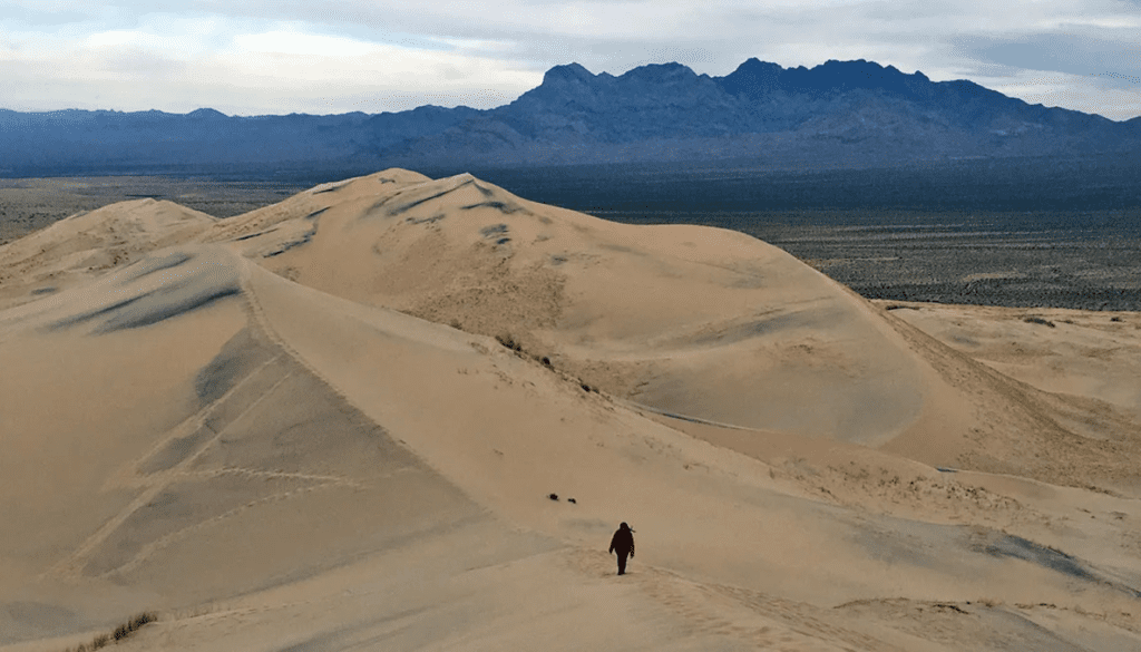
In the Mojave National Preserve, you’ll find the amazing Kelso Dunes. It’s a spot perfect for hikers, featuring beautiful sand dunes and incredible sunset views. Anyone eager for a unique experience in California’s desert should not miss the Kelso Dunes hike.
Hiking Through the Vast Sand Dunes
The hike at Kelso Dunes is about 4 miles long, offering both challenge and rewards. Hikers need to climb 700 feet and cross 45 square miles of sand. Most of the path is on the loose sand, but reaching the top is worth it for the view.
Getting ready is crucial for the Kelso Dunes hike. It starts at Baker, CA, with a 3-mile dirt road to the parking. Bring sturdy poles for balance, water, and sun protection, especially when it’s hot.
Sunset Views at Kelso Dunes
The hike’s highlight is watching the sunset from the top. When the sun sets, the dunes light up in gold, offering an amazing view. Many plan their hike to reach the peak just in time for this spectacle.
The Kelso Dunes were shaped thousands of years ago, making them a special place. The adventure is more than a great view; it’s also a lesson in the area’s geology and nature. You can see unique insects and even hear the sand dunes “booming.” This hike truly engages all your senses.
Sierra Buttes Fire Lookout
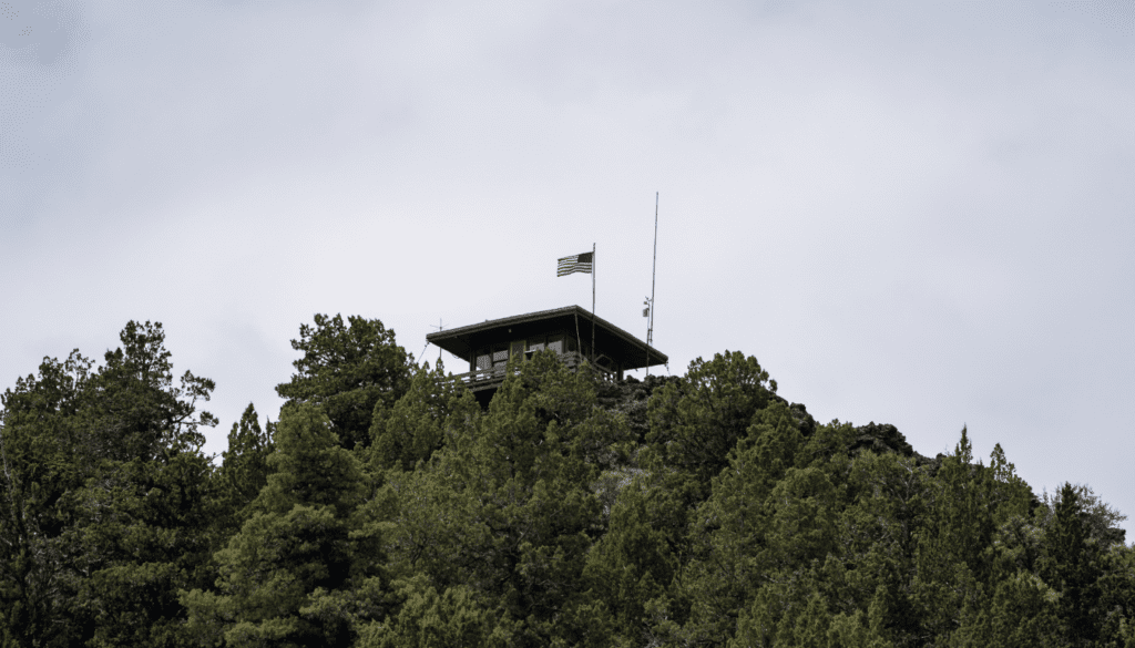
In the heart of Nevada County, California, the Sierra Buttes Fire Lookout hike awaits. It’s a perfect choice for those wanting a tough but worthwhile adventure. The trek covers 6 miles and goes through the stunning Tahoe National Forest. It has an elevation gain of about 1,800 feet.
The journey starts after turning onto Gold Lake Highway from Sierra City. Then, a left onto Packer Lake Road leads to the trailhead. Starting at 7,000 feet, in just 2.5 miles, you’ll reach an elevation gain of 1,800 feet. This makes it challenging but oh so satisfying.
Walking the trail, you’ll reach a turning point at 0.5 miles. Here, turn right to head towards the fire lookout. The path later merges with an OHV road. About a mile further is the peak with an iconic rock outcropping and the lookout.
At the top, the views are awe-inspiring. The fire lookout is perched on a cliff with a 300-foot drop, offering amazing 360-degree views. On clear days, sights like Sardines Lakes and Mt. Lassen can be seen up to 100 miles away.
The fire lookout is a piece of history, dating back to 1915. Stairs were finished in 1964 by Tahoe employees. Climbing the 150 stairs is an achievement itself. It leads to a unique moment at the top.
Remember, the Sierra Buttes hike is quite a popular choice. It’s wise to start early to beat the crowd. Also, the trail might be confusing. Sticking to the directions or going with experienced hikers can help you enjoy the trip.
The Sierra Buttes Fire Lookout hike is a highlight of the Tahoe region. It offers both a tough but memorable journey for those who love the outdoors. Whether you look for splendid views, a unique historical spot, or just some fresh air, this hike meets those needs.
“The views from the Sierra Buttes Fire Lookout are simply amazing. It’s a challenging hike, but the panoramic vistas at the top make it all worth it.”
The Mist Trail
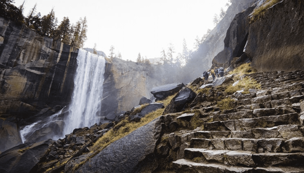
The Mist Trail in Yosemite National Park is a mesmerizing hike. It shows off the park’s famous waterfalls. You can hike it alone or part of the longer Half Dome Trail. It’s perfect for those who love adventure.
This hike is about 3 miles round-trip to Vernal Fall. It’s a grand waterfall in Yosemite. You can make it more tough by going all the way to Nevada Fall. That adds up to a 7-mile round trip.
As you hike, prepare for the beauty around you. You’ll see waterfalls and huge granite walls. It’s a tough trek, climbing 1,000 feet to Vernal Fall. Then, another 900 feet to Nevada Fall.
During the summer, this trail gets busy. Lots of people are headed to Vernal Fall. But if you go further, to Nevada Fall, it gets quieter. The hike becomes more calming.
Hiking here is hard, especially near Vernal Fall’s top. There are steps in the cliff. Make sure you wear the right shoes, drink water, and are fit. This will help you have a great hike.
The Mist Trail is a top pick for those visiting Yosemite. It’s all about the waterfalls and scenic views. The challenge and beauty of this trail will stay with you.
| Trail Details | Highlights |
|---|---|
|
|
“The Mist Trail is an unforgettable hike that showcases the power and beauty of Yosemite’s iconic waterfalls. It’s a must-do for any outdoor enthusiast visiting the park.”
best hiking trails in California
California is known for its various beautiful landscapes. It’s a top spot for both nature lovers and hikers. You can find coastal cliffs, huge redwood forests, high peaks, and big dunes across the state. We’re going to look at the best hiking trails, showing you the beauty and challenges.
The Rubicon Trail is a 13-mile path along Lake Tahoe’s shore. It’s one of California’s most famous hikes. If you want something easier, try the Barker Dam Loop in Joshua Tree. This 7.5-mile trail is set in a beautiful desert. Or, you might want the challenge of the Gray Butte hike in Mount Shasta. It’s a three-and-a-half-mile journey to stunning views.
California’s trails are very diverse. You could go on a quick walk to see the McWay Waterfall in Big Sur. Or choose a longer six-and-a-half-mile trail in Pomo Canyon in Sonoma Coast State Park. For an adventure in the city, San Francisco’s Lands End has a special loop. It lets you explore over 80,000 acres.
Whether you’re an experienced hiker or just starting, California has something for you. Visit the impressive Yosemite Falls or climb San Gorgonio Peak, standing at 11,509 feet. California’s natural beauty will amaze and inspire you. So, get your gear ready and explore the best hiking in California. You’re about to discover the top hiking destinations in California and the most scenic hikes in California.
| Hiking Trail | Distance | Elevation Gain | Difficulty Level |
|---|---|---|---|
| Rubicon Trail | 13 miles | Unknown | Intermediate |
| Barker Dam Loop | 7.5 miles (round-trip) | Unknown | Moderate |
| Gray Butte | 3.5 miles | Unknown | Expert |
| McWay Waterfall | 0.5 miles | Unknown | Easy |
| Pomo Canyon | 6.5 miles | Unknown | Moderate |
| Lands End | 3.5 miles | Unknown | Easy |
The best hiking in California offers something for everyone. You can find tough, scenic paths or easy, relaxing walks. No matter your preference – coastal walk, mountain climb, or forest hike – California’s top spots have it all. So, pack your stuff, put on your shoes, and start your adventure into the most scenic hikes in California.
Rubicon Trail
The Rubicon Trail is a must-see for everyone wanting an amazing hike next to Lake Tahoe. This trail is between 5 to 10 miles long, depending on if you use a shuttle. It gives you fantastic views of the lake’s blue water and tall peaks all the way.
It starts at D.L. Bliss State Park. As you walk, you’ll see big rocks, small bridges, and mostly flat land. The path is right by the lake for about 80% of the journey. You can see places like Emerald Bay, Vikingsholm mansion, and Fanette Island’s Tea House.
Once you’re almost done, there’s a tough climb up to the parking lot. This last part makes you feel proud. Plus, you get to see the lake from a high spot.
The Rubicon Trail is not too hard but still a good workout. You’ll walk on dirt, step on rocks, and find some steep places. So, watch your step and stay focused.
Get there early, especially on weekends and in summer. Parking can be tough at D.L. Bliss and Emerald Bay State Park. But, the views and memories from the hike are worth the $10 parking fee at each park.
If you love hiking or just being in nature, don’t miss the Rubicon Trail. It’s known for its beautiful views, tough paths, and interesting history. This hike will stay with you long after you’ve finished it.
Bridge to Nowhere
The Unique Destination
The Bridge to Nowhere hike in Azusa, California is a must-do for adventure lovers. You’ll find yourself surrounded by the rugged beauty of Southern California. The trek leads to a unique spot – a long-forgotten bridge.
This journey is filled with amazing sights. From crossing streams to passing raspberry bushes, every step is rewarding. The Bridge to Nowhere itself is awe-inspiring, with a history marked by disasters. On weekends, it’s alive with the screams of thrill-seekers plunging off it.
Trail Highlights
This trail is every nature-lover’s dream, packed with adventures:
- Length of trail: 10 miles round trip
- Elevation gain: 1,200 feet
- Multiple stream crossings
- Remnants of a broken road along the trail
- Estimated hike duration: 7 hours
- Average number of people seen on the trail: around 100 (during peak seasons)
- Bungee jumping off the bridge on weekends
- Opportunities for swimming in the river below the bridge
- Sightings of wildlife, including rattlesnakes
- Picnicking and relaxation at the bridge area
The Bridge to Nowhere hike stands out for its mix of wilderness and excitement in sunny California. Its natural beauty, the thrill of bungee jumping, and a look into the past make it unforgettable.

Conclusion
Looking at the top 10 hikes in California, it’s clear this state has a lot to offer outdoor lovers. You can go from serene, fern-filled Redwood Park to the high Sierra Nevada with its peaks and clear lakes. This means you can find both hard and easy trails to enjoy California’s stunning nature.
The hikes in this article, like the Fern Canyon Loop Trail and the Rubicon Trail, show off the state’s amazing variety. You’ll see everything from coastlines to high, flower-covered meadows. These paths cater to all levels of hikers and interests.
When you’re planning your next California adventure, be sure to check out these best hikes in California and other California outdoor adventures. They’ll give you memories for a lifetime and a new love for California’s beauty. So, put on your boots, grab your backpack, and start exploring the Golden State’s awesome hiking spots.
FAQ
What are the top 10 best hiking trails in California?
The article includes the top 10 hiking trails in California. It shows the state’s amazing variety of nature and offers stunning adventures for hikers. The trails go from the coast to the redwoods, with unique rock formations and breathtaking views.
Why is hiking important in California?
Hiking in California connects people with its natural beauty. It offers physical, mental, and spiritual benefits. The article highlights the impact of hiking and how the top 10 trails were chosen.
It includes factors like unique experiences, beautiful views, and feasibility for day trips.
What makes Fern Canyon one of the best coastal hikes in California?
Fern Canyon is a short, amazing hike. The main challenge is the drive there. It’s through a canyon full of ferns with great views, making it a top coastal hike.
Why is Lembert Dome considered an accessible yet rewarding hike in Yosemite?
Lembert Dome in Yosemite is the easiest climb. The view from the top over Tuolumne Meadows is epic. The 3-mile roundtrip is both easy and rewarding.
What makes the Whiskeytown Falls hike a favorite in California?
The Whiskeytown Falls hike is 3 miles with lots of uphill. It leads to a beautiful waterfall, a favorite for the author in California. The surrounding greens and browns enhance the waterfall’s beauty.
What are the highlights of the Taft Point and Sentinel Dome hikes in Yosemite?
Either Taft Point or Sentinel Dome in Yosemite is recommended. They both offer amazing views of Yosemite Valley. Each is a 2-mile roundtrip with a great experience.
Why is the Eagle Lake trail a must-visit hike in California?
The Eagle Lake trail starts near Emerald Bay State Park. It leads to a lake with a stunning view. It’s a steady climb to the breathtaking lakeside.
What makes the Elwodsen Trail in Big Sur a great representation of the region?
The Elwodsen Trail shows the best of Big Sur: waterfalls, forests, and coastal views. It’s about 4 miles with a steep elevation gain, but worth it for the experience.
Why is the Kelso Dunes hike a unique and unforgettable experience?
The Kelso Dunes hike is in Mojave National Preserve. It’s not long but hard due to sandy ground. Yet, it’s a top spot to see the sunset from massive dunes.
What makes the Sierra Buttes Fire Lookout hike a rewarding challenge?
The Sierra Buttes Fire Lookout hike is a 6-mile trek with a climb of 2,000 feet. It is challenging but the view from the lookout is amazing. It’s a challenge worth taking.


